Map services
Click this icon ![]() to display Maps User Guide in each application. Download Maps User Guide [PDF] (482KB)
to display Maps User Guide in each application. Download Maps User Guide [PDF] (482KB)
Park
Palace and park complex map (PL)
Service presenting Museum grounds, buildings, structures and garden sculpture located within the Park, as well as nature layer - trees, shrubs, garden parterres and monuments of nature. Discover historic architectural structures and see which plants and trees grow in Wilanów park.
Go to MapPalace façades
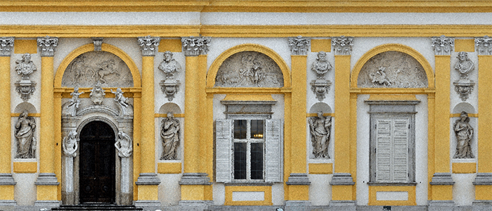
Decorative features on all façades of the Palace (PL)
Façades of the historic palace, richly decorated with elements of sculpture, painting as well as architectural decoration, constitute a very important part of the museum's historical substance. The website presents archival and current façades views in the form of orthoimages, photogrammetry and vectors, as well as data on more than 1290 separate decorative objects, with accompanying photographic, archival and conservation documentation.
Go to MapPalace interiors
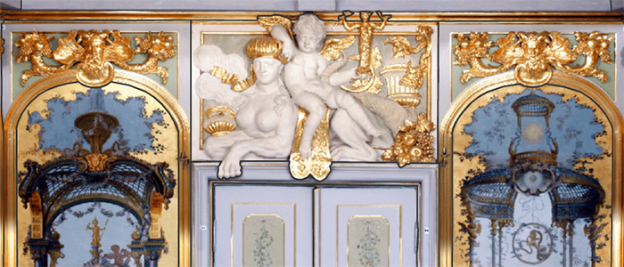
Decorations in the palace interiors (ENG)
The website provides plans of the individual floors of the Palace with information about the rooms and the sculptural, painting and architectural decoration in those historic interiors. From the floor plan view you can proceed to the other sites - views of rooms, where on the background of orthoimages of walls the decorative elements of the interior are presented. The decoration is currently developed in 46 palace interiors.
Go to MapArchaeology
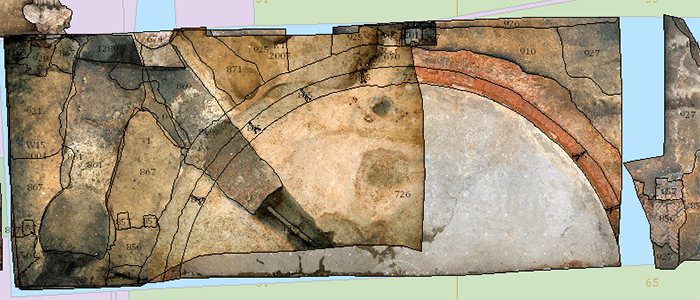
Archaeological research within the Museum grounds (PL)
The website presents the archaeological research that was carried out within the Museum grounds between 2003 and 2012. The map of Wilanów park shows individual excavations, stratigraphic units, excavation profiles and orthoimages of successive layers discovered.
Go to Map"Biodiversity"
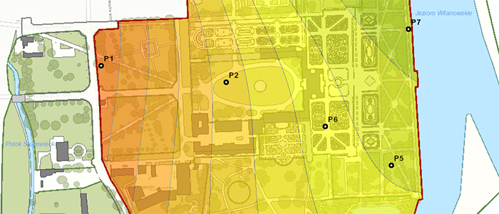
Environmental research conducted within the Museum grounds (PL)
The website presents data and research conducted between 2014 and 2016 as part of the project 'Social education in the conflict between urbanisation and ecology at the Wilanów Palace Museum'. On the website, we can see, among other things, studies of dragonfly, bird and bat populations, as well as the results of air and water research in Wilanów Park.
Go to MapOgrody OdDawna - HistoriaOdNowa
GIS Congress 2021 'Przestrzeń OdNowa' (PL)
The Museum's activities do not only include the protection of cultural heritage - architectural monuments and works of art, but also the protection of natural heritage. The Museum has custody of the historical gardens and Morysin natural reserve, moreover, it is involved in protecting natural environment in the immediate vicinity of the palace and garden complex and preserving the unique character of the place - Wilanów Cultural Park. The application was developed on the occasion of the GIS 2021 Congress 'Przestrzeń OdNowa' organised by ESRI Polska.
Go to MapHow can GIS give a different perspective on the work of a museum professional?
GIS Congress 2023 "Change your perspective" (PL)
Many people, when asked what they associate with museums and who a museum professional is, respond similarly: a museum is typically an old building full of dusty display cases, and a museum professional is a tour guide or a lady overseeing the exhibition. However, is such a view of museums in line with reality? You will find the answer to this question right here. The application was created on the occasion of the GIS Congress 2023 "Change Your Perspective" organized by ESRI Poland.
Go to MapDendrological trail
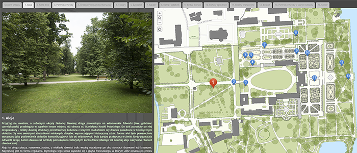
Trees and shrubs in the royal park (PL)
The website contains descriptions, photographs and interesting facts about trees and shrubs growing in Wilanów Park in the form of a virtual tour consisting of 14 characteristic points. The app was created to mark Landscape Day 2020, whose main focus are trees.
Go to MapDendrological foundations
Map of trees planted in the Wilanów park by museum contributors (PL)
The application contains a map of trees donated by contributors along with a description of the circumstances of their planting. It also includes proposed locations for planting new trees together with detailed descriptions prepared by the Garden Department.
Go to MapGIS DAY 2020
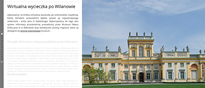
Virtual tour round the geoportal of the Museum of King Jan III's Palace at Wilanów (PL)
Enjoy a short virtual tour of the Wilanów residence, focusing on its most important owner - King Jan III Sobieski. For this purpose, we will use spatial information system maintained by the Museum of King Jan III's Palace at Wilanów and thematic map services available at the museum's website.
Go to MapExotic plants and greenhouses
Wilanów Gardens exotic plants collection
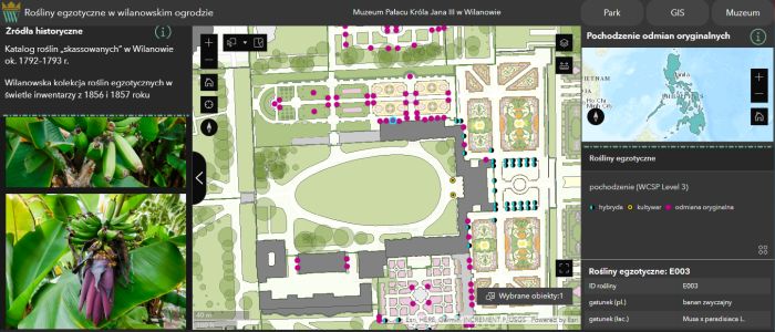
The website presents information about exotic plants that are displayed in Wilanów Gardens. You will learn what plants you can meet while walking in the park, what parts of the world they come from, where you can see them in summer and where we store them in winter. The application also contains historical and architectural data about existing and non-existent structures. The project was carried out as part of the 5th edition of the Ministry of Science and Higher Education "Implementation Doctorate" programme, in cooperation with the Cracow University of Technology and the Museum of King Jan III's Palace at Wilanów.
Go to MapHistory of changes...
... of the Museum of King Jan III's Palace at Wilanów 2003-2023
The team of the Museum of King Jan III’s Palace at Wilanów invites you to a presentation of a fragment of the achievements of the institution's contemporary history. We show the history of changes resulting from the conservation and restoration of monuments, restoration of parks and digital documentation of resources. The application is part of the temporary exhibition 'HISTORY OF CHANGES of the Museum of King Jan III’s Palace at Wilanów 2003-2023', presented from 10 May to 16 June 2024.
Go to MapAbout the project
The Museum's spatial information system under construction collects information on: grounds, buildings, park, architectural objects, garden sculpture, façades, interiors, trees and shrubs as well as archaeological findings. All spatial objects were created based on cartometric architectural and surveying documentation using ESRI's ArcGIS software. Based on the master map of the Museum grounds, separate thematic layers were created for each type of object. Each object has been assigned an attribution in a database form and accompanied by selected current and archival documentation: photographic, conservation, architectural and iconographic.
All data is divided into thematic modules. The first of these is a spatial database of the entire Museum grounds. The geodatabase contains object classes/layers such as e.g. record parcels, buildings, structures, green areas, alleys, fences and garden sculpture. These are basic object classes that are reference layers for the whole system.
The next module is a geodatabase concerning building interiors. On the basis of CAD-formatted architectural plans, the individual floors of 14 listed buildings were developed in the system in such a way, that each room is a separate polygon object. All rooms are appropriately thematically and functionally described.
Subsequently, the museum's geographic information system (GIS) was expanded to include a module containing Palace façade decoration. The development of the module was based on vector documentation in CAD format and photogrammetric documentation - façade orthoimages. The material was converted to geodatabase format. Objects were singulated and grouped into one of the following types: architectural decoration, architectural composition, painting, relief, sculpture. The database includes over 1200 decorative historical objects, each with a unique ID number and developed attributes, as well as selected current and archival documentation.
Another module implemented is a geodatabase on the decoration in Palace interiors. Forty-six interiors were developed, in which decorative objects were singulated and described.
A spatial database was also built in the GIS system for trees and shrubs of the park complex. An inventory of trees and shrubs was carried out, each tree was measured and described in the database, and its age was calculated. There are currently over 3,000 trees in the database, including 28 monuments of nature, which have their documentation enhanced with photographs and inventory cards. This geodatabase also contains layers that describe in great detail plant and non-plant elements that constitute the baroque parterres.
The following module is a geodatabase containing the results of archaeological research carried out within the Museum grounds over the last 10 years. All archaeological sites, together with the assigned georeferencing, were described in a database form. Documentation is also provided, including orthoimages of profiles, which can be visualised realistically in their locations.
In 2014-2015, as part of the project implementation 'Revitalization and digitalization of the only Polish Baroque royal residence in Wilanów', co-financed by the European Union's Regional Development Fund under the Operational Programme Infrastructure and Environment, photogrammetric data for the Palace's facade has been prepared. Project results can be accessed at: https://gis.muzeum-wilanow.pl/elewacje/pois.
In 2016, as a result of the project implementation 'Social education in the conflict between urbanisation and ecology at the Wilanów Palace Museum', implemented in 2014-2016, a module of the spatial database "Biodiversity" was created collecting data obtained from the research conducted during the project. The data collected in the geodatabase has also been made available at: https://gis.muzeum-wilanow.pl/bioroznorodnosc.
Contact
Museum of King Jan III's Palace at Wilanów
ul. Stanisława Kostki Potockiego 10/16
02-958 Warsaw
The web service administrator of the Museum of King Jan III's Palace at Wilanów Spatial Information System is the Documentation and Digitalization Department. If you have a question or want to make a comment please contact us:
Documentation and Digitalization Department
e-mail: dokumentacja@muzeum-wilanow.pl
tel: 22 5442 767
The project has been financed by KULTURA+ Multiannual Programme
 |
 |
 |
 |

